1869 Mitchell Antique Map of The State of Illinois For Cheap
Description
-
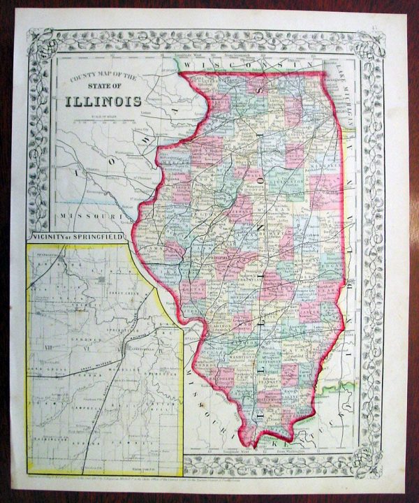
Title : County Map of the State of Illinois….1869 by S. Augustus Mitchell
- Ref #: 35045
- Size: 15in x 12in (380mm x 300mm)
- Date : 1870
- Condition: (A+) Fine Condition
Description:
This beautifully hand coloured original antique map was published by Samuel Augustus Mitchell in the 1870 edition of his large New General Atlas – dated at the foot of the map.These county, state, city & country maps are some of the most ornate and beautifully coloured maps published in the US in the 19th century. For over 50 years, Mitchell his son s and their successors were the most prominent cartographical publishers of maps and atlases in the United States.
General Description:
Paper thickness and quality: – Heavy & stable
Paper color: – White
Age of map color: – Original
Colors used: – Green, pink, yellow
General color appearance: – Authentic
Paper size: – 15in x 12in (380mm x 300mm)
Plate size: – 15in x 12in (380mm x 300mm)
Margins: – Min 1 2in (10mm)Imperfections:
Margins: – None
Plate area: – None
Verso: – None
Additional Information
| Title | Default Title |
|---|